Nav atļaujas izmantot mikrofonu
Kategorija
  • Šī izsole
  • Aktuālie
  • Arhīvs
search
Izmantojiet MI ieteikumus, lai ātrāk atrastu labākos rezultātus savām vajadzībām un vēlmēm

Nesen meklēts
Šī opcija ir pieejama tikai tiem lietotājiem, kuri ir pieteikušies
Mākslinieki
Nav
25
translate search star_border

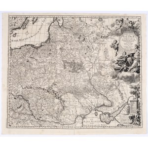
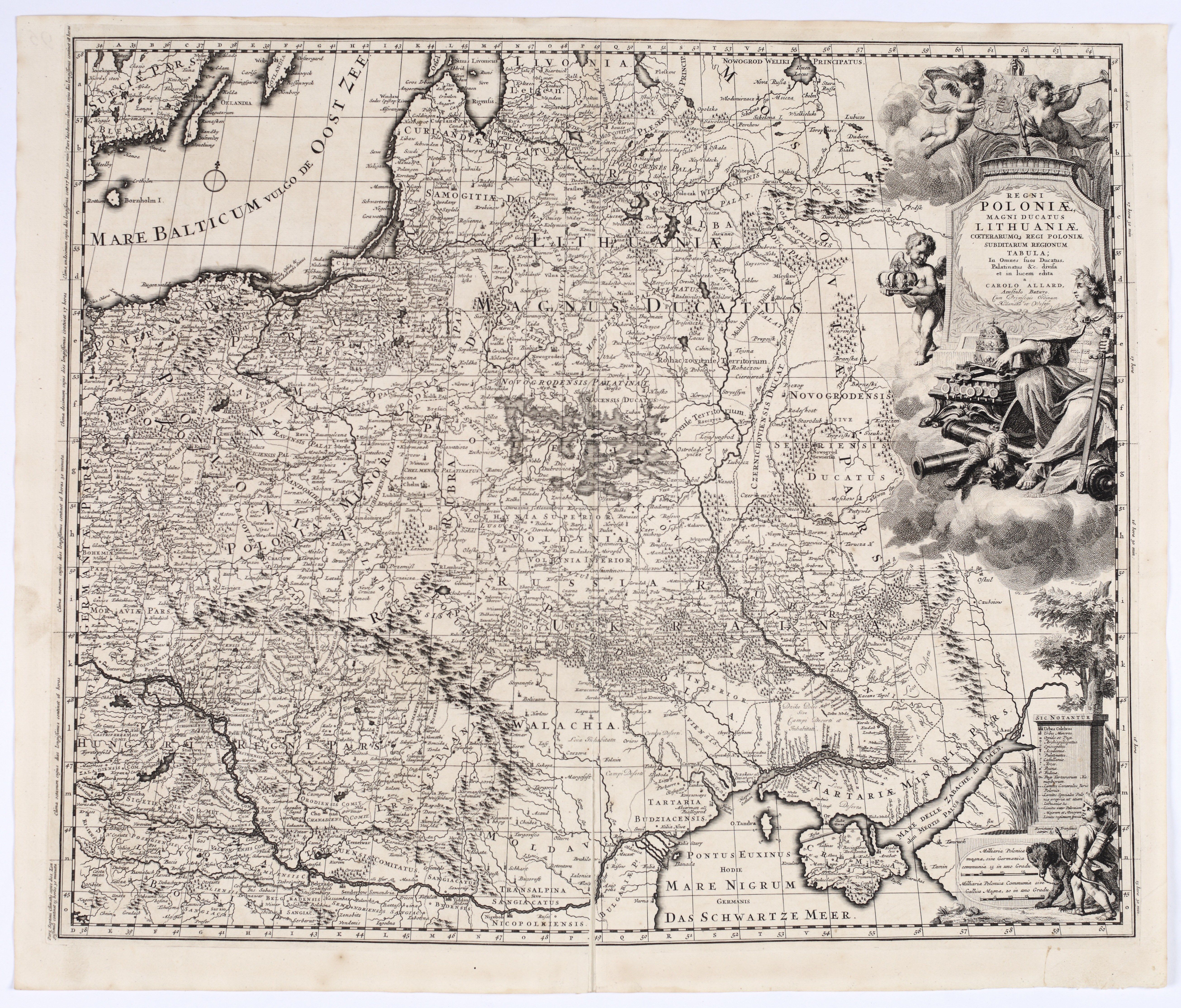
ALLARD, Carel (1648–1709) — Regni Poloniae, Magni Ducatus Lithuaniae ... Tabula. Amsterdam: ca. 1697.

Paziņojumi tiešraides izsoles laikā
notifications_off Brīdinājums: Nē
textsms SMS: Nav
add Jūsu piezīme 
Priekšmeta apraksts
ALLARD, Carel (1648–1709) — Regni Poloniae, Magni Ducatus Lithuaniae ... Tabula. Amsterdam: ca. 1697.

Copperplate engraving, paper, 495 × 590 mm, on a sheet measuring 535 × 633 mm. Verso blank. Traces of atlas folding; minor spots and creases; inventory number written on the reverse.

The map covers the entire territory of the Polish-Lithuanian Commonwealth, depicted with exceptional detail. Its scope extends from the Baltic Sea in the north—including the islands of Gotland, Öland, and Bornholm visible in the upper left corner, through Prussia, Pomerania, Greater Poland, and Lesser Poland, Lithuania, Volhynia, and Podolia in the south, all the way to Wallachia, Moldavia, the Crimean Khanate and the Black Sea, and in the east to Smolensk, Ukraine, and the Sea of Azov.
The large allegorical title cartouche in the upper right corner was engraved by G. van Gouwen based on a design by Ph. Tideman. It depicts a crowned female personification of Poland, seated on clouds, surrounded by a crown, the royal apple, a scepter, coins, and war trophies. Cherubs hold the royal coat of arms and the crown, and above them, the winged figure of Fame blows a trumpet. The title is placed on the pedestal below. A second decorative scene in the lower right corner depicts a Tatar or Cossack archer with a bow and quiver, leading a bear on a leash. Next to it is a table explaining the symbols used on the map and the distance scales.

Carel Allard was the most prominent member of a family of cartographers, engravers, and publishers active in Amsterdam during the second half of the 17th century and the early 18th century. His father, Hugo (or Huych) Allard (c. 1625–1691), also published a map of Poland based on Guillaume Le Vasseur de Beauplan’s *Nova totius Regni Poloniae descriptio*. Carel’s map is a significantly expanded and more detailed version of Beauplan’s influential map, enriched with numerous additions and corrections drawn from later 17th-century sources.

The map was published shortly after Frederick Augustus, Elector of Saxony, ascended the Polish throne; in 1697, he became King of Poland as Augustus II. The elaborate allegorical cartouche alludes to his conversion to Catholicism, while the depicted royal regalia, war trophies, and personifications of Fame and Poland emphasize the political dimension of the composition. For another map published by the Allard family, see Item 31.

One of the most beautiful old maps of Poland.

Imago Poloniae H27/1.
Izsole
Senu Polijas un Austrumeiropas karšu un skatu izsole. XV–XIX gadsimts.
gavel
Datums
27 Septembris, 18:00 CEST/Warsaw
date_range
Sākuma cena
1 973 EUR
Izsoles tiešraides sākums
Ej uz izsoli
Piesakies izsolei
Nosaki cenu jau tagad
Piesakies, lai noteiktu cenu

Vai vēlaties noteikt cenu? Piesakieties izsolei.

Pieslēgties
PLN .00

Piedāvājumu pieņemšana: 27/09 18:00 CEST/Warsaw
Izsoles tiešraides sākums: , 27/09 18:00 CEST/Warsaw

Nekavējoties paaugstiniet preces cenu. Iesniedziet piedāvājumu, ja vēlaties noteikt cenu par preci, kas tika izsolīta iepriekš. Uzmanību: piedāvājumus nevar atcelt!

Izveidot ierobežojumu
Piesakies, lai noteiktu cenu

Vai vēlaties noteikt cenu? Piesakieties izsolei.

Pieslēgties
PLN .00

Pēc tam, kad izsoles procesā esat iestatījis cenu ierobežojumu,lote tiks automātiski izsolīta Jūsu vārdā līdz jūsu noteiktajam limitam. Limits ir slēpts piedāvājums, tā vērtība citiem lietotājiem nav zināma un tiek aktivizēta tikai tiešās solīšanas laikā, līdzīgi kā Allegro vai eBay izsolēs. Iestatītos limitus var mainīt līdz lotes izsoles sākumam.

Nosūtiet ziņu izsoles rīkotājam

Vai jums ir jautājumi par šo loti vai cenu noteikšanu?

Skatījumi: 136 | Iecienītākie: 7
Kā izsolīt
Nākamais solis
Piesakies izsolei
1 / 4

Krok 1
double_arrow Piesakies izsolei
Reģistrējieties izsolei savlaicīgi un aizpildiet nepieciešamo informāciju, negaidiet līdz pēdējam brīdim
Krok 2
cancel Pārlūkot katalogu
Iepazīstieties ar izsoles katalogu un atrodiet kaut ko sev. Saglabājiet interesējošos vienumus, lai saņemtu paziņojumus
Krok 3
cancel Piedalīties izsolē
Kad sākas tiešraides izsole, pievienojieties licitēšanai un uzvariet: Kā licitēt tiešraidē?
Krok 4
cancel Pārbaudīt rezultātus
Informāciju par izsoles rezultātiem un jūsu laimestiem varat atrast savā Profilā, jūs saņemsiet arī e-pasta paziņojumu

Uzzināt vairāk: Help centre

Kā izsolīt
1

Piesakies izsolei

2

Pārlūkot katalogu

3

Piedalīties izsolē

4

Pārbaudīt rezultātus

Reģistrējieties izsolei savlaicīgi un aizpildiet nepieciešamo informāciju, negaidiet līdz pēdējam brīdim
Iepazīstieties ar izsoles katalogu un atrodiet kaut ko sev. Saglabājiet interesējošos vienumus, lai saņemtu paziņojumus
Kad sākas tiešraides izsole, pievienojieties licitēšanai un uzvariet: Kā licitēt tiešraidē?
Informāciju par izsoles rezultātiem un jūsu laimestiem varat atrast savā Profilā, jūs saņemsiet arī e-pasta paziņojumu

Uzzināt vairāk: Help centre

Izsole

Antykwariat Antiquo Modo

Senu Polijas un Austrumeiropas karšu un skatu izsole. XV–XIX gadsimts.
Datums
Svētdiena, 27 Septembris, 18:00 CEST/Warsaw
Izsoles gaita

Visas lotes tiks izsolītas

Izsoles maksa
20.00%
OneBid neiekasē papildus maksu par izsoli.
Cenu palielinājumi
  1
  > 10
  200
  > 20
  500
  > 50
  1 000
  > 100
  2 000
  > 200
  5 000
  > 500
  10 000
  > 1 000
  20 000
  > 2 000
  50 000
  > 5 000
∞
 
Noteikumi un nosacījumi
Par izsoli
FAQ
Par pārdevēju
Antykwariat Antiquo Modo
Kontakts
Antykwariat Antiquo Modo
room
ul. Kielecka 7 / 2B
31-526 Kraków
phone
+48503447570
Maksājums
Bankas pārskaitījums: PLN
keyboard_arrow_up
Help centre open_in_new