Nav atļaujas izmantot mikrofonu
Kategorija
  • Šī izsole
  • Aktuālie
  • Arhīvs
search
Izmantojiet MI ieteikumus, lai ātrāk atrastu labākos rezultātus savām vajadzībām un vēlmēm

Nesen meklēts
Šī opcija ir pieejama tikai tiem lietotājiem, kuri ir pieteikušies
Mākslinieki
Nav
2
translate search star_border

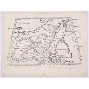
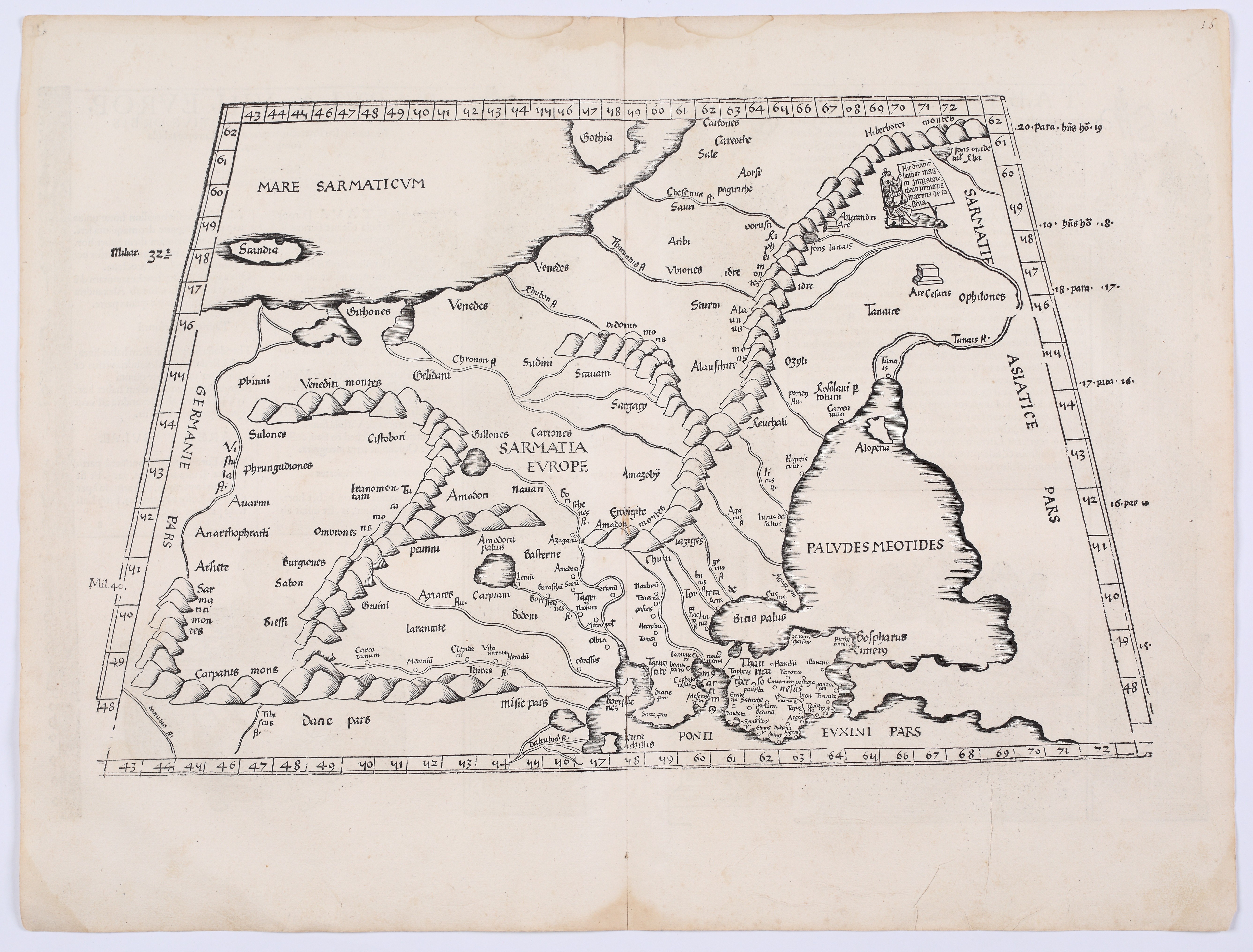
CLAUDIUS PTOLEMY (c. 100 – c. 168); Lorenz Fries (1489–1532) — Tabula VIII Europae: Sarmatia Europae. Lyon: Melchior and Gaspar Trechsel, 1535.

Paziņojumi tiešraides izsoles laikā
notifications_off Brīdinājums: Nē
textsms SMS: Nav
add Jūsu piezīme 
Priekšmeta apraksts
CLAUDIUS PTOLEMY (c. 100 – c. 168); FRIES, Lorenz (1489–1532) — Tabula VIII Europae: Sarmatia Europae. Lyon: Melchior and Gaspar Trechsel, 1535.

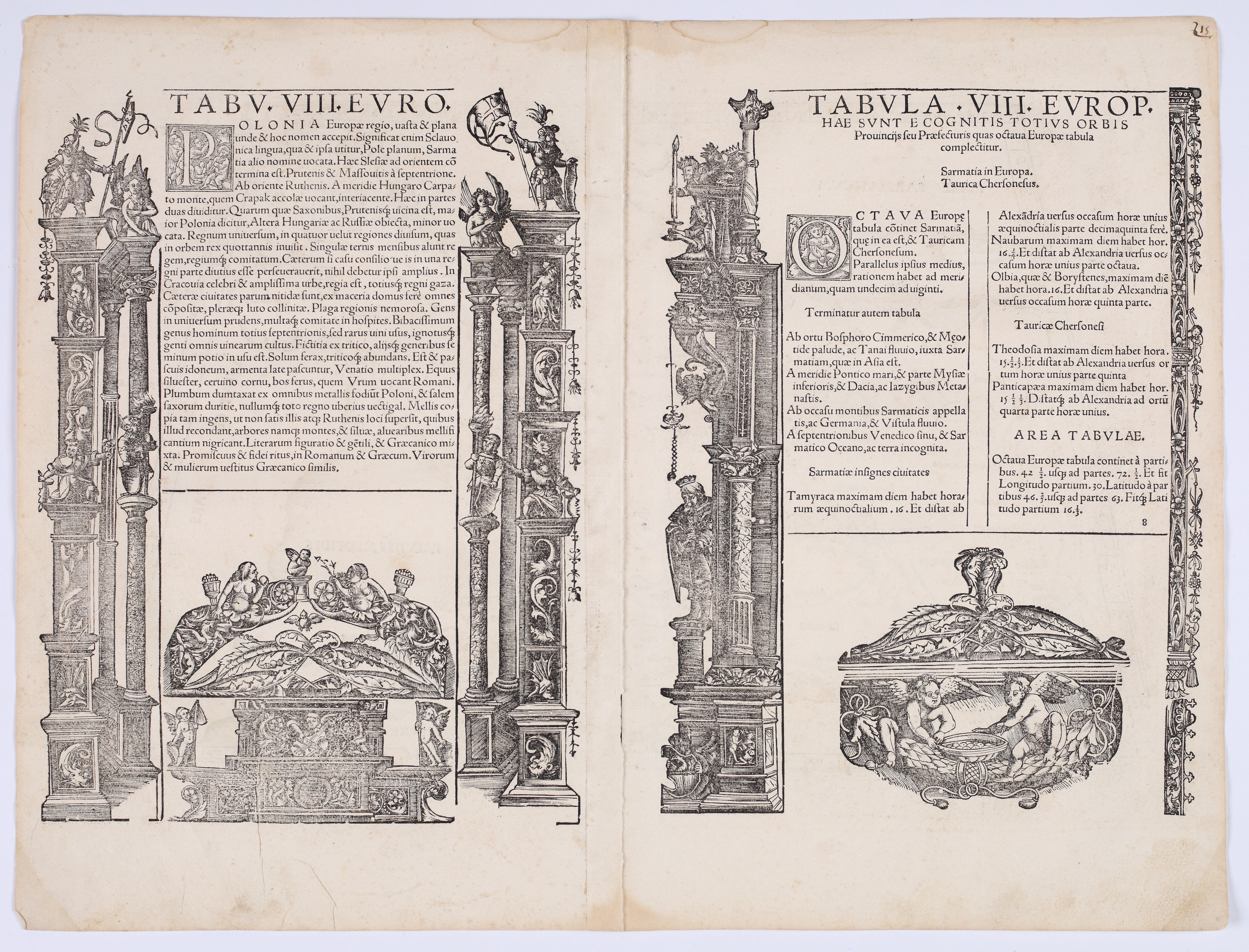
Woodcut, paper, 405 × 533 mm. On the reverse, a text in Latin within an ornate architectural woodcut frame. The paper is slightly yellowed, with minor discoloration on the upper and lower margins and traces of atlas folding.

A beautiful map depicting European Sarmatia—an ancient geographical term for a vast region encompassing the territories of present-day Poland, Ukraine, Belarus, and western Russia—stretching from Germania and the Baltic Sea in the west and north to the Don River and the Sea of Azov in the east; the southern border is marked by the northern coast of the Black Sea. The Crimean Peninsula, along with the Cimmerian Bosporus, is clearly depicted in the lower right corner. The map retains the characteristic conventions of Ptolemy’s cartography: graduated frames for longitude and latitude, stylized mountain ranges depicted in a distinctive “caterpillar-like” form, and river systems based on ancient sources. Among the more important geographical names are Tanais (Don), Borysthenes (Dnieper), Carpatus Mons, as well as numerous names of peoples and tribes—the Venedes, Guthones, Sauani, and Iazyges—reflecting Ptolemy’s synthesis of ancient geographical knowledge.

The map is accompanied by two text panels containing a description of Poland, framed by elaborate Renaissance architectural borders featuring columns, putti, and allegorical figures. In the text, Kraków is mentioned as the royal capital; in the context of the city, there is also mention of abundant supplies of wood, honey, and salt, as well as the customs of its inhabitants. The index contains a list of provinces and their coordinates.

The map was published in the third edition of Ptolemy’s *Geographia*, edited by Lorenz Fries and printed in Lyon by Melchior and Gaspar Trechsel. Fries compiled the maps primarily by reducing the maps from the landmark edition of Ptolemy’s work, published by Martin Waldseemüller in 1513. The first and second editions appeared in Strasbourg in 1522 and 1525, respectively; the second was edited by the Nuremberg humanist Willibald Pirckheimer, who drew on the observations of the astronomer Johannes Regiomontanus. The woodcut blocks subsequently passed into the hands of the Lyon printers Melchior and Gaspar Trechsel, who reused them in editions from 1535 and 1541.
Izsole
Senu Polijas un Austrumeiropas karšu un skatu izsole. XV–XIX gadsimts.
gavel
Datums
27 Septembris, 18:00 CEST/Warsaw
date_range
Sākuma cena
882 EUR
Izsoles tiešraides sākums
Ej uz izsoli
Piesakies izsolei
Nosaki cenu jau tagad
Piesakies, lai noteiktu cenu

Vai vēlaties noteikt cenu? Piesakieties izsolei.

Pieslēgties
PLN .00

Piedāvājumu pieņemšana: 27/09 18:00 CEST/Warsaw
Izsoles tiešraides sākums: , 27/09 18:00 CEST/Warsaw

Nekavējoties paaugstiniet preces cenu. Iesniedziet piedāvājumu, ja vēlaties noteikt cenu par preci, kas tika izsolīta iepriekš. Uzmanību: piedāvājumus nevar atcelt!

Izveidot ierobežojumu
Piesakies, lai noteiktu cenu

Vai vēlaties noteikt cenu? Piesakieties izsolei.

Pieslēgties
PLN .00

Pēc tam, kad izsoles procesā esat iestatījis cenu ierobežojumu,lote tiks automātiski izsolīta Jūsu vārdā līdz jūsu noteiktajam limitam. Limits ir slēpts piedāvājums, tā vērtība citiem lietotājiem nav zināma un tiek aktivizēta tikai tiešās solīšanas laikā, līdzīgi kā Allegro vai eBay izsolēs. Iestatītos limitus var mainīt līdz lotes izsoles sākumam.

Nosūtiet ziņu izsoles rīkotājam

Vai jums ir jautājumi par šo loti vai cenu noteikšanu?

Skatījumi: 107 | Iecienītākie: 3
Kā izsolīt
Nākamais solis
Piesakies izsolei
1 / 4

Krok 1
double_arrow Piesakies izsolei
Reģistrējieties izsolei savlaicīgi un aizpildiet nepieciešamo informāciju, negaidiet līdz pēdējam brīdim
Krok 2
cancel Pārlūkot katalogu
Iepazīstieties ar izsoles katalogu un atrodiet kaut ko sev. Saglabājiet interesējošos vienumus, lai saņemtu paziņojumus
Krok 3
cancel Piedalīties izsolē
Kad sākas tiešraides izsole, pievienojieties licitēšanai un uzvariet: Kā licitēt tiešraidē?
Krok 4
cancel Pārbaudīt rezultātus
Informāciju par izsoles rezultātiem un jūsu laimestiem varat atrast savā Profilā, jūs saņemsiet arī e-pasta paziņojumu

Uzzināt vairāk: Help centre

Kā izsolīt
1

Piesakies izsolei

2

Pārlūkot katalogu

3

Piedalīties izsolē

4

Pārbaudīt rezultātus

Reģistrējieties izsolei savlaicīgi un aizpildiet nepieciešamo informāciju, negaidiet līdz pēdējam brīdim
Iepazīstieties ar izsoles katalogu un atrodiet kaut ko sev. Saglabājiet interesējošos vienumus, lai saņemtu paziņojumus
Kad sākas tiešraides izsole, pievienojieties licitēšanai un uzvariet: Kā licitēt tiešraidē?
Informāciju par izsoles rezultātiem un jūsu laimestiem varat atrast savā Profilā, jūs saņemsiet arī e-pasta paziņojumu

Uzzināt vairāk: Help centre

Izsole

Antykwariat Antiquo Modo

Senu Polijas un Austrumeiropas karšu un skatu izsole. XV–XIX gadsimts.
Datums
Svētdiena, 27 Septembris, 18:00 CEST/Warsaw
Izsoles gaita

Visas lotes tiks izsolītas

Izsoles maksa
20.00%
OneBid neiekasē papildus maksu par izsoli.
Cenu palielinājumi
  1
  > 10
  200
  > 20
  500
  > 50
  1 000
  > 100
  2 000
  > 200
  5 000
  > 500
  10 000
  > 1 000
  20 000
  > 2 000
  50 000
  > 5 000
∞
 
Noteikumi un nosacījumi
Par izsoli
FAQ
Par pārdevēju
Antykwariat Antiquo Modo
Kontakts
Antykwariat Antiquo Modo
room
ul. Kielecka 7 / 2B
31-526 Kraków
phone
+48503447570
Maksājums
Bankas pārskaitījums: PLN
keyboard_arrow_up
Help centre open_in_new